Tag: Cyclone

  • Cyclone Biparjoy spared lives

    Cyclone Biparjoy spared lives

    Ahmedabad: Cyclone Biparjoy has left a trail of destruction in Gujarat’s Kutch and Saurashtra regions as some 1,000 villages are still without power with hundreds of electric poles getting damaged, while several coastal villages were flooded due to heavy rains and incoming seawater, officials said on Friday, a day after the storm made landfall.

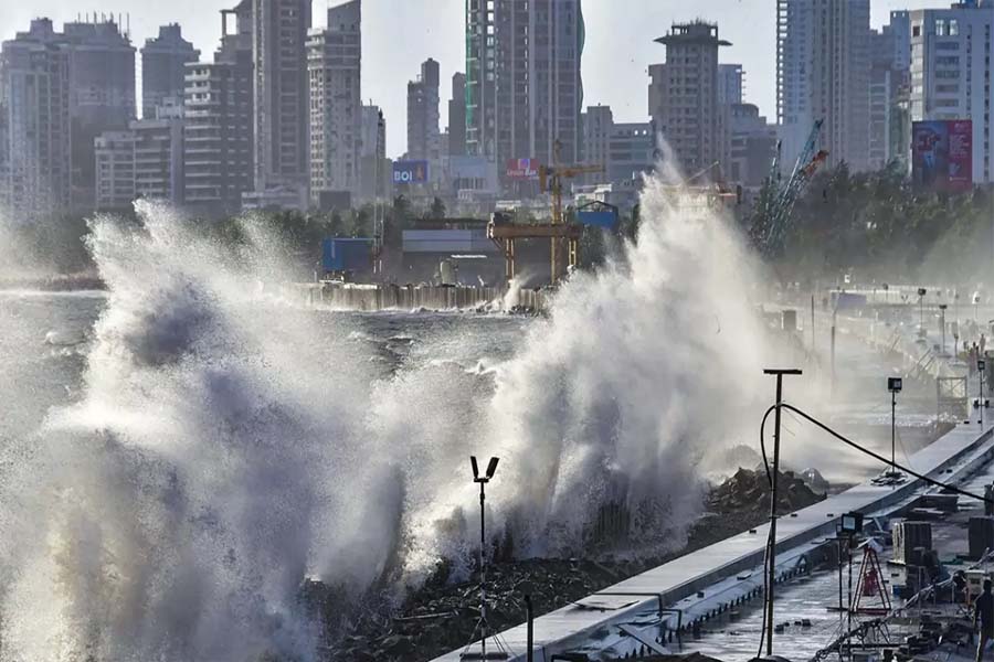
    There was no loss of life in the state on account of the cyclone which was the “biggest achievement,” a senior official said. Cyclone Biparjoy (`biparjoy’ means calamity in Bengali) made landfall along Saurashtra-Kutch coasts near Jakhau around 6:30 pm on Thursday as a ‘very severe cyclonic storm’, bringing incessant rains and wind speeds of as high as 140 kmph. The landfall was over by 2.30 am on Friday.

    “The biggest achievement for the state is that not a single human death has been reported so far due to cyclone Biparjoy. This has been possible because of our collective effort,” state Relief Commissioner Alok Kumar Pandey told reporters. But the storm caused extensive financial loss to the state power utility Paschim Gujarat Vij Company Limited with 5,120 electricity poles getting damaged, he said.
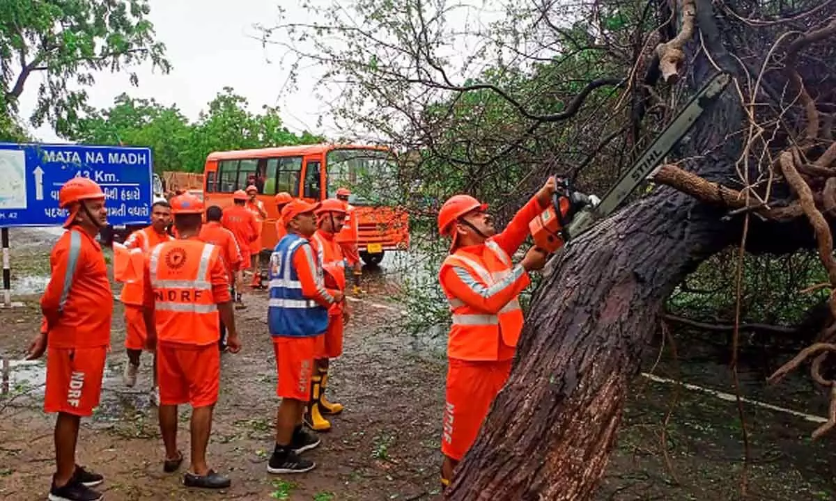
    As many as 4,600 villages were left without power, but electricity supply was restored in 3,580 villages, he added. Nearly 600 trees got uprooted and traffic on three state highways came to a standstill, the officials said, adding that at least 23 people were injured due to cyclone-related incidents while many houses were also damaged.

    “Three state highways were closed as they suffered damage and saw felling of trees.”

    “A total of 581 trees were uprooted as per reports. Nine pucca and 20 kutcha houses collapsed, and two pucca and 474 kutcha houses suffered partial damage,” he said.

    Sixty-five thatched houses were destroyed, and the government was preparing an order for immediate compensation to those who have suffered losses due to the cyclone, the official added. On Mandvi -Jakhau highway, fallen trees and electric poles could be seen every 100 or 200 meters. In the Kacha village near Mandvi around 25 kutcha houses were damaged.

    “We do not have electricity since yesterday. But no untoward incident has taken place in the village,” Saranch of Kacha Rakesh Gaur said. “In our shelter homes we have housed 400 people from Salaya and other villages on the coast for the last four days,” he added. In Mandvi town, around 30 trees and 20 electric poles were uprooted. “We do not have electricity since 4 pm yesterday. Thatched roofs of our houses were blown away and the houses were inundated with water,” said Mandvi resident Abdul Hussain.

    `Severe Cyclone Storm’ (SCS) Biparjoy weakened into a Cyclonic Storm (CS) on Friday and was seen as gradually weakening into a deep depression by the evening. With the cyclone moving further inland, authorities in the north Gujarat districts of Banaskantha and Patan were bracing for its impact by shifting people in low-lying areas to shelters as the India Meteorological Department (IMD) has forecast extremely heavy rainfall likely in isolated places in the two districts. “SCS BIPARJOY weakened into CS at 0830IST of today and lay near lat 23.4N and long 69.5E, about 30km WNW of Bhuj, likely to weaken further into a deep depression over Saurashtra & Kutch around evening of today,” the IMD tweeted. Parts of Kutch district will receive extremely heavy rainfall, it said. It also warned of heavy to very heavy rainfall at isolated places with isolated extremely heavy rains in Banaskantha till Sunday morning, and in Patan till Saturday morning. Relief commissioner Pandey said that with the situation improving, over one lakh people who were relocated to safe places ahead of the landfall of the cyclone — one of the largest such operations in the history of the state — will now be shifted back to their homes. Banaskantha collector Varun Baranwal said that more than 2,500 people have been relocated to safe places and more people from low-lying areas were being evacuated. “We have kept 25,000 food packets ready,” he said. The IMD said the remaining districts of Gujarat were also likely to receive isolated heavy rainfall on Friday. Rainfall in north Gujarat districts could also cause damage to houses and roads and uproot trees, it warned. Districts of Kutch, Devbhumi Dwarka, Jamnagar, Bhavnagar, Banaskantha and Morbi received very heavy rainfall, with Gandhidham, Bhuj, Anjar and Mundra talukas in Kutch district and Khambhalia in Devbhumi Dwarka receiving up to 100-200 mm rainfall in the 24 hours preceding Friday morning. Parts of Jamnagar, Kutch, Devbhumi Dwarka, Rajkot, and Morbi received heavy rainfall in six hours since Friday morning, data provided by the State Emergency Operation Centre (SEOC) showed. More tha

  • ‘Biparjoy’ On Course To Become Cyclone With Longest Lifespan In Arabian Sea

    ‘Biparjoy’ On Course To Become Cyclone With Longest Lifespan In Arabian Sea

    Cyclone Biparjoy, expected to cross the Gujarat coast on June 15, is on course to become the cyclone with the longest lifespan in the Arabian Sea, according to the India Meteorological Department (IMD) data.

    It will also be the third cyclone to hit the western state in June since 1965, the meteorological office said.Based on data from 1965 to 2022 for the month of June, 13 cyclones developed over the Arabian Sea. Of these, two crossed the Gujarat coast, one Maharashtra, one Pakistan coast, three Oman-Yemen coasts and six weakened over the sea,” the IMD said.

    Before 2023, only two cyclones crossed the Gujarat coast in June. One was a severe cyclone in 1996 and the other was an extremely severe cyclonic storm in 1998, it said.

    The life period of Cyclone Biparjoy, which developed over the southeast Arabian Sea at 5.30 am on June 6, is about seven days and 12 hours so far.

    The extremely severe Cyclone Kyarr of 2019 over the Arabian Sea had a life of 9 days and 15 hours. It developed over the east-central Arabian Sea, had multiple recurvatures and weakened over the southwest Arabian Sea.

    The very severe cyclonic storm Gaja of 2018 over the southeast Bay of Bengal had a life span of 9 days and 15 hours. It crossed the southern peninsular region, emerged into the Arabian Sea and weakened there, the IMD said.

    Cyclone Biparjoy is predicted to cross Saurashtra and Kutch and the adjoining Pakistan coasts between Mandvi in Gujarat and Karachi in Pakistan near Jakhau Port (Gujarat) around noon of June 15 as a very severe cyclonic storm with a maximum sustained wind speed of 125-135 kmph gusting to 150 kmph.

    According to meteorologists, Cyclone Biparjoy underwent rapid intensification in the initial days and has sustained its strength due to an unusually warm Arabian Sea.

    The IMD has issued a heavy rainfall warning for several districts in Gujarat, including Kutch, Devbhumi Dwarka, Porbandar, Jamnagar, Rajkot, Junagarh, and Morbi.

    It has also recommended completely suspending fishing operations in the east-central, west-central and north Arabian Sea till June 15.

    Heavy to extremely heavy rainfall is very likely in parts of Kutch, Devbhumi Dwarka, Jamnagar, Porbandar, Rajkot, Morbi and Junagarh districts of Gujarat on June 15. Gusty winds and rain may cause major damage to standing crops, houses, roads, power and communication poles, and flooding of escape routes.

    There is a possibility of disruption in the functioning of railways, overhead power lines and signalling systems.

  • Low Pressure Forms Over Bay Of Bengal; Cyclone Biparjoy Moves Closer To Coast

    Low Pressure Forms Over Bay Of Bengal; Cyclone Biparjoy Moves Closer To Coast

    Bhubaneswar: People in Odisha can expect some relief from the sweltering heat with a low pressure area forming over northeast Bay of Bengal off Myanmar coast, India Meteorological Department (IMD) informed on Friday.

    The system is likely to become well marked during next 24 hours, it added.

    The IMD further said that very severe cyclonic storm Biparjoy, located over the east-central and adjoining southeast Arabian Sea, is set to intensify further in 36 hours and will be heading north-northwestwards in the next two days. Under its influence, coastal areas of Karnataka, Maharashtra, Goa, and Kerala are likely to experience high speed wind and harsh weather. Wind speed of 135-145 kmph gusting to 160 kmph is likely in the next three-four days. The MeT office has warned fishermen against venturing into the sea.

    Biparjoy was centered approximately 820 km west-southwest of Mumbai, 830 km south-southwest of Porbandar, and 1120 km south of Karachi at 8.30 am.

    Based on the atmospheric conditions and cloud mass analysis, it is anticipated that the system will maintain the intensity of a Very Severe Cyclone until June 12.

  • Cyclone likely in Bay of Bengal around May 9: IMD

    Cyclone likely in Bay of Bengal around May 9: IMD

    BHUBANESWAR: A summer cyclone is likely to take place in the Bay of Bengal around May 9 though details of its path and intensification was not assessed as yet, the IMD said on Wednesday. IMD Director General Mrutunjay Mohapatra said the guidance of numerical models indicate formation of a cyclonic storm around May 9, but its movement and intensification may be determined after the low pressure area forms on May 7. However, there is no forecast so far regarding landfall over the country’s coast. But fishermen are advised against venturing into the sea from May 7, he said.

    Keeping in view the weather development, the Odisha government has already put collectors of 18 coastal and adjoining districts and officials of 11 departments on the alert, its special relief commissioner Satyabrata Sahu said on Wednesday. Mohapatra said a cyclonic circulation is to be formed over southeast Bay of Bengal around May 6 and under its influence, a low pressure area is likely to form over the same region around May 7. The system is likely to concentrate into a depression over southeast Bay of Bengal on May 8. “There is a good possibility of the circulation intensifying into a cyclonic storm while moving towards the central Bay of Bengal around May 9. The system is being constantly watched and monitored regularly,” he said.

    Stating that predicting the path of summer cyclones is very difficult, the IMD DG told a local TV news channel that the details of its path and intensity will be provided after the low pressure area is formed. Asked about the likely impact on Odisha coast, Mohapatra said no alert has been issued for it or any other place on the east coast.

    The information on the cyclone is aimed at updating fishermen, oil explorers or any other commercial operations being carried out in the Bay of Bengal, Mohapatra said that people were urged not to panic about a possible cyclone. Mohapatra said April, May and June are considered as summer cyclone months, while September, October and November are monsoon cyclone months. The east coast has witnessed three summer cyclones – Fani, Amphan and Yaas in the month of May in 2019, 2020 and 2021 respectively.

    A statement by Odisha’s SRC’s office said : “As per the tropical weather outlook dated May 3, 2023, issued by IMD, the development of cyclonic circulation around 6th of May is under constant watch. IMD will communicate details of its path and intensity. No warning have been issued by IMD for Odisha coast.” However all cyclone prone districts are kept in a state of readiness. Districts and line departments along with the NDRF, ODRAF and others are in readiness for any possible eventuality.

  • Chief Minister Naveen Patnaik Reviews Preparedness For Possible Cyclone ‘Mocha’

    Chief Minister Naveen Patnaik Reviews Preparedness For Possible Cyclone ‘Mocha’

    Bhubaneswar: In view of the possible formation of cyclone ‘Mocha’ over the Bay of Bengal, Odisha Chief Minister Naveen Patnaik on Tuesday chaired a high-level meeting to review preparedness.

    Recalling cyclone ‘Fani’ of 2019, the Chiev Minister said it is difficult to accurately determine the path of cyclones formed during summer season. Therefore, the admiistration should remain prepared to deal with any situation, he said.

    The Chief Minister directed the officials and departments concerned to remain in a state of readiness to tackle any kind of eventuality. NDRF, ODRAF and Fire Services personnel should also be prepared.

    Emphasising that every life is previous, Naveen also advised the officials to take steps for shifting of people residing in low-lying and vulnerable areas to cyclone shelters, if necessary.

    The Chief Minister also directed them to chalk out plans in advance for relief and restoration works in the aftermath of cyclone.

    The CM also directed the Chief Secretary to review the situation regularly and asked the Special Relief Commissioner (SRC) to work in coordination with all departments.

    Chief Secretary Pradip Kumar Jena said all efforts will be made to ensure zero casualty during the calamity. All Collectors have been alerted in this regard. Around 1000 cyclone shelters are ready, while more safe places, including school buildings have been identified, he said.

    Giving details of preparedness, SRC Satyabrata Sahu said round-the-clock control rooms have been set up after holding discussion with Collectors of 18 districts. As many as 17 NDRF and 20 ODRAF teams have been kept ready for the possible cyclone, he said.

    Though summer cyclones are always unpredictable, there is no need to panic as all necessary steps are being taken to deal with any situation.

    In the past, several cyclones have been formed over the Bay of Bengal including Fani in 2019, Amphan in 2020 and Yaas in 2021. State-level and district-level control rooms have been set up and the situation is being closely monitored even though no cyclone forecast has been issued by IMD so far, he said.

    It may be noted here that a low pressure area is likely to form over the Bay of Bengal around May 7, the India Meteorological Department (IMD) said.

    Though the IMD was yet to predict whether the low pressure area will intensify into a cyclonic storm or not, international meteorologist Jason Nicholls has forecast that the system may intensify into a cyclone and impact areas between eastern India and Myanmar.

    A precise prediction regarding the path and intensity of the system can be made after formation of the low pressure area, weather experts opined. The system will be called cyclone ‘Mocha’ if it becomes a cyclonic storm.