Tag: IMD

  • Chance of heavy rain, Meteorological Department issued alert

    Chance of heavy rain, Meteorological Department issued alert

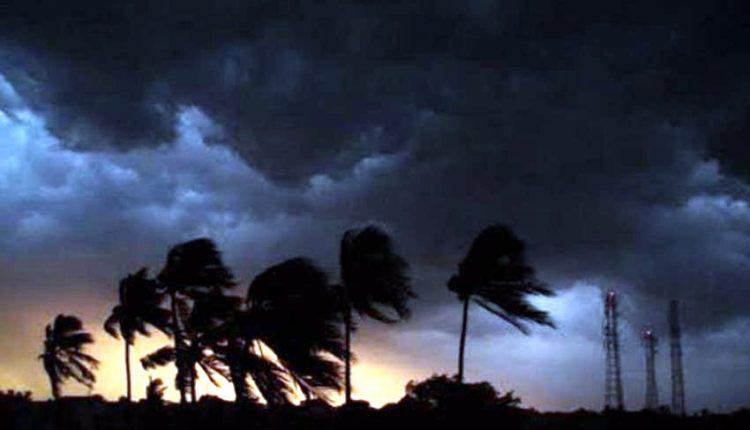
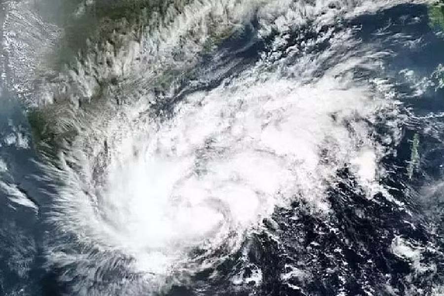
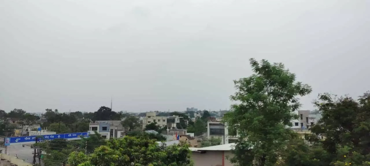
    Bhopal. Monsoon has entered Madhya Pradesh. Monsoon has knocked in many places of the state including capital Bhopal. However, monsoon has reached Madhya Pradesh five days late from Mandla, Shahdol. The Meteorological Department has predicted heavy rains at some places in the state for the next five days. According to the Meteorological Department, rainfall activity will increase across the state, while there is a possibility of good rains in eastern and western Madhya Pradesh.

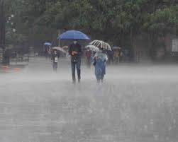
    Talking about Chhattisgarh, monsoon has knocked in many places of the state including Raipur. Due to the influence of the monsoon system, heavy to very heavy rainfall is possible in some areas of the state today. Lightning may also fall at some places. The Meteorological Department has expressed the possibility of extremely heavy rains in Dantewada, Sukma, Bijapur. Heavy rains are possible in Bilaspur, Raigarh, Korba, Gariaband, Dhamtari, Kondagaon, Kanker Narayanpur. At the same time, the possibility of rain has been expressed in the capital today. Meteorologist H.P. Chandra said that rain is possible in many places of the state today. Heavy to very heavy rainfall is also possible in some places.

  • Rain, Squall@40Kmph To Strike 21 Odisha Districts This Evening

    Rain, Squall@40Kmph To Strike 21 Odisha Districts This Evening

    Bhubaneswar: The India Meteorological Department (IMD) has issued now cast warning for 21 districts of Odisha till 7.30 pm on Wednesday.

    Light to moderate rain, thunderstorm with lightning and gusty surface wind with speed reaching up to 30-40 kmph is likely to affect some parts of Balasore, Cuttack, Dhenkanal, Mayurbhanj, Keonjhar, Bhadrak, Deogarh, Angul, Bargarh, Nuapada, Balangir, Sambalpur, Sundargarh, Kalahandi, Kandhamal, Nayagarh, Rayagada, Ganjam, Gajapati, Bodh and Jajpur districts in 3 hours.

    The MeT office had earlier issued similar warning for five coastal districts – Balasore, Cuttack, Dhenkanal, Khurda and Jajpur – till 5.30 pm.

    People have been advised to keep a watch on the weather and accordingly move to safer places to protect themselves from lightning strikes.

  • Bhubaneswar Sizzles At 44.3 Degrees Celsius, IMD Issues Orange Warning

    Bhubaneswar Sizzles At 44.3 Degrees Celsius, IMD Issues Orange Warning

    Odisha’s capital Bhubaneswar on Monday sizzled at 44.3 degrees Celsius which is more than 8.3 degrees than the normal temperature while as many as 31 places across the state recorded temperatures of 40 degrees Celsius or more, the MeT office said.

    Temperature above 5 degrees Celsius than the normal temperature in the coastal area is considered a severe heatwave condition.

    The weather office issued an orange warning (be prepared) for the heatwave to severe heatwave conditions at a few places over the district of Jharsuguda, Sambalpur, Bargarh, Sonepur, Boudh, and Bolangir on Tuesday and Wednesday.

    It also issued a yellow warning (be updated) and said heatwave condition is very likely to prevail at one or two places over the district of Sundergarh, Keonjhar, Mayurbhanj, Angul, Dhenkanal, Deogarh, Kandhamal, Nuapada, Kalahandi, Nayagarh, Khurda, Cuttack, Ganjam and Jajpur, during the same period.

    The normal life across the state including the twin cities of Bhubaneswar and Cuttack (43.2) was severely affected due to
    heatwave condition and there seems to be no respite as the IMD forecast said similar weather will continue for two more days,

    The IMD said that the day temperature on Monday breached 45 degrees Celsius in two places. Sambalpur was the hottest place in the state at 46.1 degrees Celsius and it was followed by Hirakud at 45.6 degrees Celsius and Sonepur at 45 degrees Celsius.

    While Bargarh recorded 44.9 degrees Celsius, Bolangir, Boudh, Titlagarh, Nayagarh, and Talcher registered 44 degrees Celsius. It was followed by Angul (43.9), Jharsuguda (43.4), Rourkela (43.2), Dhenkanal, Cuttack, and Nuapada (43.2).

    Bhubaneswar encountered both hot and humid conditions as the temperature soared to 44.3 degree Celsius and humidity level was at 88 per cent.

    The IMD said that there is no large change in maximum temperature (day temperature) during the next five days at many places in the state. Rather, it is likely to be above normal by 4-7 degree Celsius at a few places during the period, it said.

    The weather office also forecast thunderstorms with lightning very likely at one or two places over the districts of Malkangiri, Koraput, Nabarangpur, Kalahandi, Gajapati, Ganjam, Keonjhar, Mayurbhanj, Balasore, and Bhadrak.

  • Cyclone Biparjoy Likely To Make Landfall Between Gujarat’s Kutch And Pakistan’s Karachi: IMD

    Cyclone Biparjoy Likely To Make Landfall Between Gujarat’s Kutch And Pakistan’s Karachi: IMD

    Cyclone “Biparjoy” intensified into an “extremely severe cyclonic storm” on Sunday morning and is likely to make landfall between Kutch district of Gujarat and Karachi in Pakistan on June 15, the India Meteorological Department (IMD) said.

    The meteorological office has issued a cyclone alert for Saurashtra and Kutch coasts. The very severe cyclonic storm ‘Biparjoy’ (pronounced as “Biporjoy”) over the east-central Arabian Sea moved north-north-eastwards with a speed of nine kmph during past six hours, intensified into an extremely severe cyclonic storm and lay centered at 0530 hours over the same region, about 580 km west-southwest of Mumbai, 480 km south-southwest of Porbandar, 530 km south-southwest of Dwarka, 610 km south-southwest of Naliya and 780 km south of Karachi (Pakistan),” the IMD said in a bulletin.

    The cyclone is very likely to move nearly northward till the morning of June 14, then move north-northeast wards and “cross Saurashtra and Kutch and adjoining Pakistan coasts between Mandvi (Gujarat) and Karachi (Pakistan) around noon of June 15 as a very severe cyclonic storm with maximum sustained wind speed of 125-135 kmph gusting to 150 kmph”, it said.

    Senior Scientist at the IMD, DS Pai, said the exact place where it will make landfall will become clearer in the coming days.

    There has been considerable uncertainty in the track and intensity of cyclone Biparjoy since it developed on June 6.

    According to meteorologists, the storm underwent rapid intensification in the initial days and has sustained its strength due to a warmer Arabian Sea.

  • IMD issues yellow warning for 14 districts of Odisha

    IMD issues yellow warning for 14 districts of Odisha

    Bhubaneswar: The regional center of the Indian Meteorological Department (IMD) has issued a yellow warning for lightning and rain in 14 districts of Odisha. The weather has been cloudy since morning.

    The effect of Kalabaishakhi will be seen in the coastal districts of the state.

    Yesterday, the effect of Kalbaeshakhi was major. Suddenly, the sky was covered with clouds with wind blowing at high speed. The capital city also experiences lightning and thunder.

    The weather suddenly changed in the afternoon in Bhubaneswar. Due to wind, trees fall at various places in the capital city.

    There was a brief power outage due to a broken power line. The dust storm was followed by rain. The influence of Kalbaishakhi was seen in Puri, Khurda, Cuttack, Jagatsinghpur, and Kendrapada.

    In Bhubaneswar, an intense dust storm, especially in Patia and Prasanti Vihar area, was witnessed on Thursday afternoon. Soon, heavy rain accompanied by thunderstorms and squally winds also occurred and wreaked havoc in parts of Bhubaneswar City.

    Vehicular movements were disrupted in different areas of the city following water logging due to the heavy downpour. Besides, several trees also broke and fell on the roads. Later, several teams of firefighters rushed to the spots and cleared the road by chopping off the trees.

    Not only in Bhubaneswar, but the northwestern rain also created havoc in different parts of Cuttack City, which also sizzled at 41.6 degree Celsius temperature.

  • IMD Issues Yellow Warning For Places In Himachal Pradesh

    IMD Issues Yellow Warning For Places In Himachal Pradesh

    The weather office here on Wednesday issued a yellow warning for thunderstorm and lightning at isolated places across the state. The state is likely to see the beginning of a wet spell on Wednesday which will continue till Saturday, it said.

    During the spell, areas in the low and mid hills are expected to receive light to moderate rain and snowfall, the MeT said.Anticipating damage to standing crops, fruit-bearing plants, and seedlings, the Indian Meteorological Department has advised farmers to make adequate arrangements and reschedule the spraying of insecticides.

    On Tuesday, no significant change was recorded in the minimum and maximum temperatures across the state. Keylong in Lahaul and Spiti district was coldest at night, recording a low of 3.4 degrees Celsius, IMD data showed.

    During the pre-monsoon season from March 1 to May 16, Himachal Pradesh received 223.4 mm of rain against a normal of 214 mm, an excess of four per cent.

  • IMD predicts light to moderate rainfall in Delhi-NCR

    IMD predicts light to moderate rainfall in Delhi-NCR

    NEW DELHI: The India Meteorological Department (IMD) has predicted a pleasant spell of light to moderate intensity rainfall in the national capital and its neighbouring regions on Wednesday.

    “Thunderstorm/dust storm with light to moderate intensity rain and gusty winds with speed of 30-50 km/h would occur over and adjoining areas of many places of Delhi, North Delhi, North-East Delhi, North-West Delhi, West Delhi, Central-Delhi, East Delhi,” the IMD said in a tweet.It also predicted light rain in NCR areas including Loni Dehat, Hindon AF Station, Ghaziabad, Indirapuram, Chhapraula, Sonipat, Rohtak, Kharkhoda, Baraut, Bagpat, Meerut, Khekra, Modinagar, Kithor, Garhmukteshwar, Pilakhua, Hapur, Gulaoti, Siyana, Sikandrabad, Bulandshahar and Jahangirabad.

    “Light to moderate intensity intermittent rain would occur over and adjoining areas of Adampur, Hissar, Hansi, Meham (Haryana) during next two hours,” the Department said in another tweet.Meanwhile, the Air Quality Index (AQI) in Delhi fell from the “moderate” to the “poor” category on Wednesday morning.

    According to the System of Air Quality and Weather Forecasting And Research (SAFAR), the city’s overall AQI was recorded at 271.

    An AQI between zero and 50 is considered “good”, 51 and 100 “satisfactory”, 101 and 200 “moderate”, 201 and 300 “poor”, 301 and 400 “very poor”, and 401 and 500 “severe”.

    As per experts, the air quality is likely to deteriorate further in the coming days. As per SAFAR data, the AQI at Mathura Road, Lodhi Road and Pusa were recorded at 320, 315 and 266, respectively, all under the “very poor” category.

    -IANS

  • Cyclone Mocha: Why The Name & IMD’s Prediction On Its Probable Path

    Cyclone Mocha: Why The Name & IMD’s Prediction On Its Probable Path

    Bhubaneswar: Amid the forecast that there is a good chance that the low pressure over the Southeast Bay of Bengal will produce a cyclonic storm, national media reported that Cyclone Mocha might make a landfall on the eastern coast of the country.

    Citing India Meteorological Department’s (IMD) Thursday predicted, the India Today said that the storm is likely to make landfall in Odisha, West Bengal between May 7 and May 9.

    According to the IMD, a cyclonic circulation is likely to develop over Southeast Bay of Bengal around May 6. Under its influence a low pressure area is likely to form over the same region around May 9. It is likely to concentrate into a depression over Southeast Bay of Bengal on May 8. Thereafter, it is likely to intensify into a cyclonic storm while moving nearly northwards towards central Bay of Bengal. The details of its path and intensification will be provided after the formation of low pressure area, it added.

    “No prediction has been made about the path and intensity of the possible cyclonic storm yet. We have not made any prediction about its impact on Odisha. We will speak about it once the low pressure forms,” IMD DG Mrutyunjay Mohapatra said on Friday.

    Times Now reported that the system over the Bay of Bengal would intensify into a cyclonic storm in Chennai and surrounding areas this weekend.

    The IMD in its Tropical Weather Outlook issued on Thursday said that IMD-GFS weather model indicates that the system may move towards Bangladesh-Myanmar coast and intensify into very severe cyclonic storm category. While the cyclonic storm may take shape around May 9, the model indicated north-northwestwards movement till May 10 and northeastwards recurvature thereafter towards southeast Bangladesh and adjoining Myanmar coasts.

    According to European Centre for Medium-Range Weather Forecasts (ECMWF), the low pressure over Southeast Bay of Bengal may form around May 7, Depression over the same region and adjoining South Addaman Sea around May 9 with gradual north-northwestwards movement and intensification into cyclonic storm around May 10. It indicated north-northeastwards recurvature from May 11 onwards towards Myanmar coast.

    NCMRWF Unified Model (NCUM), on the other hand, indicated northwestwards movement towards Tamil Nadu coast and emergence into southeast & adjoining eastcentral Arabian Sea.

    American GFS, however, said that the possible cyclone is heading towards Bangladesh coast.

    According senior meteorologist Jason Nicholls, the low pressure may form in the Bay of Bengal this weekend, then become a cyclonic storm Mocha next week. “Can threaten NE India & Bangladesh,” he tweeted.

    Image

    Meanwhile, the MeT office has issued advisory for fishermen, warning them against venturing into the Bay of Bengal, which is likely to experience squally weather with gusty winds up to the speed of 50 kmph due to the cyclonic disturbance from May 6. The wind speed might gradually increase to 50 kmph on May 8 and May 9, resulting in rough sea conditions.

    Upon its intensification into a cyclonic storm, the system will be called Cyclone Mocha, a name suggested by Yemen. It originates from the Yemeni city Mocha (or Mokha) located on the Red Sea coast, which is known for its coffee trade. Mocha is a chocolate-flavoured warm beverage that is a variant of coffee.

    Mocha is one of the 1,689 titles issued by IMD.

  • Cyclone likely in Bay of Bengal around May 9: IMD

    Cyclone likely in Bay of Bengal around May 9: IMD

    BHUBANESWAR: A summer cyclone is likely to take place in the Bay of Bengal around May 9 though details of its path and intensification was not assessed as yet, the IMD said on Wednesday. IMD Director General Mrutunjay Mohapatra said the guidance of numerical models indicate formation of a cyclonic storm around May 9, but its movement and intensification may be determined after the low pressure area forms on May 7. However, there is no forecast so far regarding landfall over the country’s coast. But fishermen are advised against venturing into the sea from May 7, he said.

    Keeping in view the weather development, the Odisha government has already put collectors of 18 coastal and adjoining districts and officials of 11 departments on the alert, its special relief commissioner Satyabrata Sahu said on Wednesday. Mohapatra said a cyclonic circulation is to be formed over southeast Bay of Bengal around May 6 and under its influence, a low pressure area is likely to form over the same region around May 7. The system is likely to concentrate into a depression over southeast Bay of Bengal on May 8. “There is a good possibility of the circulation intensifying into a cyclonic storm while moving towards the central Bay of Bengal around May 9. The system is being constantly watched and monitored regularly,” he said.

    Stating that predicting the path of summer cyclones is very difficult, the IMD DG told a local TV news channel that the details of its path and intensity will be provided after the low pressure area is formed. Asked about the likely impact on Odisha coast, Mohapatra said no alert has been issued for it or any other place on the east coast.

    The information on the cyclone is aimed at updating fishermen, oil explorers or any other commercial operations being carried out in the Bay of Bengal, Mohapatra said that people were urged not to panic about a possible cyclone. Mohapatra said April, May and June are considered as summer cyclone months, while September, October and November are monsoon cyclone months. The east coast has witnessed three summer cyclones – Fani, Amphan and Yaas in the month of May in 2019, 2020 and 2021 respectively.

    A statement by Odisha’s SRC’s office said : “As per the tropical weather outlook dated May 3, 2023, issued by IMD, the development of cyclonic circulation around 6th of May is under constant watch. IMD will communicate details of its path and intensity. No warning have been issued by IMD for Odisha coast.” However all cyclone prone districts are kept in a state of readiness. Districts and line departments along with the NDRF, ODRAF and others are in readiness for any possible eventuality.

  • Eastern India may experience heat wave in May, says IMD

    Eastern India may experience heat wave in May, says IMD

    Parts of eastern India, including Bihar, Jharkhand and Odisha, are likely to face above-normal temperatures in May with a likelihood of heat wave conditions on some days, the weather office has said.

    However, parts of northwest and west-central India may experience warmer nights and below-normal temperatures during the day, the India Meteorological Department said in the monthly outlook for temperature and rainfall for May.

    It said normal to above-normal rainfall is expected in the northwest and west central parts of the country in May, including in Punjab, Haryana, Rajasthan and parts of western Uttar Pradesh. Large swathes of the northeastern region, Kerala, Andhra Pradesh and south Karnataka, are expected to witness below-normal rains.

    According to the weather office, the average rainfall in May is likely to be 91-109 per cent of the Long Period Average of 61.4 mm.

    “Above-normal heat wave days are expected over most parts of Bihar, Jharkhand, Odisha, Gangetic West Bengal, east Uttar Pradesh, coastal Andhra Pradesh and some parts of North Chhattisgarh, east Madhya Pradesh, Telangana and coastal Gujarat during May,” IMD Director General Mrutyunjay Mohapatra said here.

    He said the neutral El Nino prevalent over the equatorial Pacific region is expected to continue through May with a majority of weather models indicating the region beginning to warm up during the monsoon season.

    El Nino, or warming of the equatorial Pacific Ocean, is said to have an impact on monsoon rains in India. However, other factors such as the sea surface temperatures in the Indian Ocean (known as the Indian Ocean Dipole) are also known to influence the weather.

    Mohapatra said the neutral IOD conditions prevailing over the Indian Ocean are likely to turn positive during the upcoming season. He said positive Indian Ocean Dipole conditions are known to favour the Indian monsoon and help temper the impact of El Nino.

    Earlier this month, the IMD forecast a normal monsoon season with 96 per cent rainfall of the Long Period Average of 87 cm rainfall. The weather office is expected to update its forecast towards the end of May.