Tag: rain

  • Rain Lashes Delhi, Maximum Temp Dips To 34.5 Deg C

    Rain Lashes Delhi, Maximum Temp Dips To 34.5 Deg C

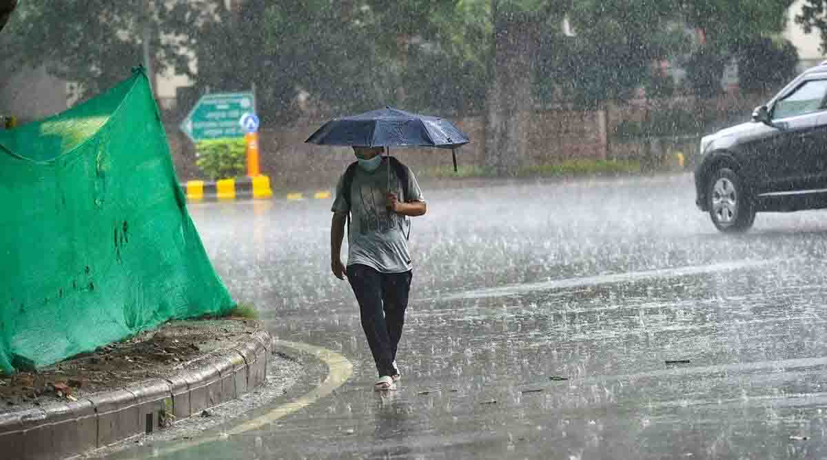
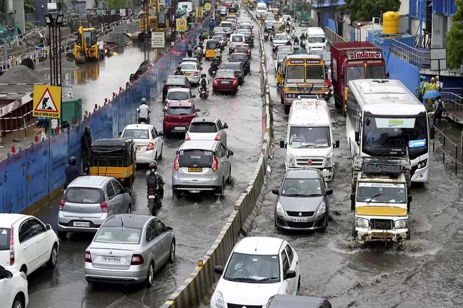
    Another spell of rain lashed Delhi on Monday under the influence of cyclone Biparjoy’s remnant, bringing down the maximum temperature to 34.5 degrees Celsius, four notches below normal.

    The India Meteorological Department has predicted more rain over the next two days. Maximum temperatures are expected to remain below the 40-degree mark for the next four to five days.The Safdarjung Observatory, Delhi’s primary weather station, recorded 4.4 mm of rainfall on Monday. It has gauged 15.9 mm of rainfall against a normal of 31.1 mm so far, a deficit of 49 per cent.

    The IMD’s extended range model guidance shows an upswing in rains over northwest India in June last week.

    The Met office is yet to announce a date for the arrival of monsoon in Delhi. Normally, the rain-bearing system reaches the capital by June 27.

    The Safdarjung Observatory has not recorded any heatwave this year so far, with meteorologists attributing it to higher-than-usual western disturbances — weather systems that originate in the Mediterranean region and bring unseasonal rainfall to northwest India — this pre-monsoon season (March to May).

    According to IMD data, the Safdarjung Observatory has so far recorded 86.7 mm of rainfall in May. On average, the national capital logs 19.7 mm of rainfall in the whole month.

    The city logged more than 20 mm of rainfall in April, the highest in the month since 2017, and heatwave conditions at isolated pockets.

    -With PTI Input

  • Monsoon will enter Chhattisgarh from June 15 to 17

    Monsoon will enter Chhattisgarh from June 15 to 17

    Raipur. After the intense heat in the state, the weather pattern has changed on Tuesday. Many districts of the state including the capital Raipur are cloudy. There was a sudden change in the weather and after the cloud cover the winds also started blowing. Let us tell you that the monsoon is going to knock in the state between June 15 and 17. Earlier, the weather pattern changed in the state. There is a possibility of rain in many places of the capital Raipur.

    According to the Meteorological Department, there may be a drop in the temperature in Bastar division. The advance of the monsoon system will bring respite from the heat.

  • Rain, Gusty Wind To Lash Bhubaneswar, Cuttack Again In 3 Hours Today

    Rain, Gusty Wind To Lash Bhubaneswar, Cuttack Again In 3 Hours Today

    Bhubaneswar: The India Meteorological Department (IMD) has issued nowcast warning for twin cities of Odisha – Cuttack and Bhubaneswar – and Jagatsinghpur till 7.15 pm on Thursday

    These places are likely to experience light to moderate rain, thunderstorm with lightning and gusty surface wind speed reaching 30-40 kmph in 3 hours. People have been advised to keep a watch on the weather and accordingly move to safer places to protect themselves from lightning strikes.

    The state capital and a few other places had experience heavy rain and thunderstorm accompanied by surface wind speed reaching 40-50 kmph on Wednesday afternoon, which provided some relief from gruelling heat. There was also temporary power cuts for some time in the city. The thunderstorm activity was witnessed as mercury soared to 41.2 degrees Celsius in Bhubaneswar.

    Notably, yellow warning for thunderstorm with lightning has been issued for one or two places in Balasore, Bhadrak, Jajpur, Kendrapada, Cuttack, Jagatsinghpur, Puri, Khurda, Nayagarh, Ganjam, Gajapati, Keonjhar, Mayurbhanj, Kandhamal, Rayagada and Koraput till Friday morning. There is a heatwave warning for some places for 3 days.

  • Lightning fell with rain, one killed, 2 youths injured

    Lightning fell with rain, one killed, 2 youths injured

    Raipur. The weather has suddenly changed in Chhattisgarh some time ago, it is believed to be the knock of pre-monsoon. Different reports are coming from many districts of the state, somewhere there is news of strong wind, somewhere there is news of rain and somewhere there is news of death due to lightning. The weather has suddenly changed amidst the ongoing heavy heat in the state.

    Bad news has come from Manendragarh, the new district of the state, here one youth has died due to lightning, while the condition of two is serious. All the three youths were standing under the mango tree when lightning struck here, in which one youth died on the spot and two youths were seriously injured. This incident is of Badgaonkala area of Janakpur police station.

    Here in Jashpur district, it is raining in the district with strong wind, people have definitely got relief from the heat due to the rain, and the weather has cooled down due to the rain. At the same time, the weather pattern has changed in Sarangarh district, it is drizzling with strong winds. Please tell that the temperature had reached 43 degrees here. People have breathed a sigh of relief from the rain.

  • There may be drizzle during 24 hours, Raipur Meteorological Department gave an update

    There may be drizzle during 24 hours, Raipur Meteorological Department gave an update

    Raipur. The Meteorological Department has issued an alert regarding the weather in Chhattisgarh. Heat wave warnings have been issued in many districts of the state. Heat wave warning has been issued in 8 districts including capital Raipur. The Meteorological Department has warned of heat wave in the state for the next 24 hours. These include plain districts like Rajnandgaon, Raipur, Balodabazar, Durg, Janjgir Champa, Raigarh, Mahasamund and Mungeli.

    Let us tell you that the effect of the activated Western Disturbance is now slowly visible in many states. In Chhattisgarh too, rain was seen in many districts since Saturday morning. Due to this, the temperature has come down and people have also got relief from the heat. Raipur Meteorological Department has issued warnings for many districts. Drizzle may occur at some places in the districts of Raipur, Bilaspur division during the next 24 hours. Pre Monsoon is likely to arrive after June 10. The main monsoon is expected to arrive after June 15.

  • Nor’wester Rain, Thunderstorm & Gusty Wind To Continue In Odisha; Change In Day Temp Unlikely

    Nor’wester Rain, Thunderstorm & Gusty Wind To Continue In Odisha; Change In Day Temp Unlikely

    Bhubaneswar: Odisha will continue to experience nor’wester rain with thunderstorm with lightning and gusty surface wind speed reaching 40-50 kmph at some places till Friday morning, the India Meteorological Department (IMD) informed on Thursday.

    Yellow warning has been issued for Keonjhar, Mayurbhanj, Jajpur, Bhadrak, Balasore, Dhenkanal, Cuttack, Khurda, Gajapati and Ganjam till 8.30 am tomorrow. Thunderstorm with lightning is also likely at one or two places in Kendrapada, Jagatsinghpur, Puri, Nayagarh and Kandhamal during this period. There is also a forecast for light to moderate rain at a few places in coastal Odisha, Keonjhar, Mayurbhanj and Dhenkanal and at one or two places in Sundargarh, Angul, Boudh, Kandhamal, Rayagada, Malkangiri, Koraput and Nabarangpur.

    Thunderstorm with lightning and gusty surface wind speed reaching 30-40 kmph is likely at one or two places in Gajapati, Ganjam, Koraput, Malkangiri, Rayagada, Mayurbhanj and Balasore in the subsequent 24 hours. Rain may continue in coastal Odisha, Mayurbhanj, Keonjhar, Dhenkanal, Rayagada, Kandhamal, Malkangiri, Koraput and Nabarangpur.

    There is also yellow warning for thunderstorm with lightning for one or two places in Malkangiri, Koraput, Rayagada, Gajapati, Ganjam, Mayurbhanj, Balasore, Bhadrak and Jajpur on Saturday. Light to moderate rain is also likely to occur at one or two places in coastal Odisha, Keonjhar, Mayurbhanj, Rayagada, Malkangiri and Koraput on this day.

    It will continue to rain in some southern and coastal areas for another 2 days.

    The MeT office further said there will be no large change in the day temperature at many places in the state during the next 5 days. “The mercury will soar to 42oC or more at a few places in interior Odisha – Sundargarh, Sambalpur, Angul, Boudh, Sonepur, Bargarh, Balangir, Kalahandi, Jharsuguda and Nuapada,” it said.

    People have been advised to take precautionary measures while going outside during day time between 11 am and 3 pm.

    At least 22 places in the state recorded maximum temperature of 40 degree Celsius or above on Wednesday. Both Sonepur and Angul turned out to be the hottest places in the state with day temperature of 44.1 degree Celsius.

  • TN likely to get another spell of rain from next week

    TN likely to get another spell of rain from next week

    CHENNAI: Tamil Nadu is likely to witness another spell of rain from next week due to a low-pressure area that is likely to form over southeast Bay of Bengal on May 7, and concentrate into a depression the following day, the Regional Meteorological Centre (RMC) said on Friday. However, the maximum temperature is expected to increase gradually by two to four degree Celsius for the next two days in isolated places of TN.

    A cyclonic circulation is likely to develop over the Southeast Bay of Bengal on May 6. Under its influence, a low-pressure area is likely to form over the same region around May 7. It is likely to concentrate into a depression over the southeast Bay of Bengal on Monday.

    “The system is expected to intensify into a cyclonic storm while moving nearly northwards towards central Bay of Bengal.

    “Initially, light to moderate rain is predicted over Tamil Nadu, because usually when the cyclonic storm moves northwards there is less chance of rain for TN. However, when the system further intensifies, and the direction changes towards the coastal area, heavy rain is likely to occur in the state,” said P Senthamarai Kannan, Scientist E, RMC, Chennai.

    Additionally, fishermen are advised not to venture into the sea until the system over the sea moves from the Bay of Bengal. As squally weather with wind speed reaching 40 kmph to 45 kmph gusting to 55 kmph is likely to prevail over Comorin area, Gulf of Mannar, Tamil Nadu coastal areas and Southwest Bay of Bengal off Sri Lanka coast.

    For the next 48 hours, the maximum temperature in Tamil Nadu especially over the coastal and interior districts is likely to surge at least by two – four degree Celsius due to the cyclonic circulation over coastal Tamil Nadu and neighborhood now lies off Tamil Nadu coast at 1.5 km above mean sea level. “A few areas in Chennai and its suburbs are expected to receive mild showers along with thunderstorm activity during the evening hours for two days. The temperature level would record around 36 degree Celsius and 27 degree Celsius in Nungambakkam and Meenambakkam weather stations,” said the RMC official.

    As several districts of Tamil Nadu witnessed heavy rain in the last 24 hours, the highest rainfall was recorded in Cuddalore 16 cm. Followed by Erode 11 cm, Kallakurichi 10 cm, Perambalur, Namakkal, Virudhungar, Pudukottai and Thiruvannamalai received 9 cm of rainfall each, as per RMC data on Friday.

  • Two spells of rain add to Monday blues

    Two spells of rain add to Monday blues

    Hyderabad: Hyderabad continued to reel from unseasonal weather on Monday, receiving a spell of rainfall in the morning and again in the evening which left key roads waterlogged and several arterial lanes inundated.

    Among the worst-hit areas in the evening spell of rains were Trimulgherry, Kanajiguda, Balanagar, Quthbullapur, Alwal, Bandlaguda, Uppal, Malkajgiri, Hayathnagar, Bahadurpura, Charminar and Singareni Colony in Saroornagar.

    Roads in Purana Haveli, Shalibanda and Malakpet were flooded, with commuters and residents wading through knee-deep water.

    A road in Filmnagar was also washed away by the rains, following which the Greater Hyderabad Municipal Corporation’s town planning section identified dilapidated buildings and started issuing notices to ensure structural integrity.

    Further, civic officials warned against unauthorised constructions and said that all under-construction sites must be well-barricaded, with safety measures in place.

    The areas of Koti, Himayatnagar, Secunderabad, Tarnaka, Kompally, Moula Ali, Rajendranagar, Old City, Osmania University, Malakpet, Saroornagar, Nampally, Dilsukhnagar, Balapur, LB Nagar, Vanasthalipuram, Nagole, Neredmet, Musheerabad, Hayathnagar, Keesara, Medipally, Masab Tank, Mehdipatnam, Attapur and Shaikpet received moderate to heavy rains for around half an hour in the morning.

    Quthbullapur recorded the highest rainfall, at 30.8 mm, followed by Bandlaguda and Uppal, at 29.3 mm each, as per the TS Development and Planning Society report.

    The India Meteorological Department (IMD) said that the state will experience more rain due to the trough running from west Vidarbha to south-interior Karnataka, across Marathwada and north-interior Karnataka, with mainly low-level south-easterly winds.

    On Monday, there was no relief for districts, which continued to receive heavy to very heavy rainfall.

    Hanamkonda, Jagtial, Jayashankar Bhupalapally, Karimnagar, Kamareddy, Khammam, Macherial, Nagarkurnool, Nizamabad, Peddapalli, Ranga Reddy, Rajanna Siricilla, Wanaparthy, Yadadri Bhuvanagiri reported heavy to very heavy rainfall, while Jagtial, Medak, Rajanna Sircilla and Siddipet also recorded hailstorms.

    The highest rainfall in the state on Monday was at Siddipet, at 33.5 mm, followed Medchal-Malkajgiri, at 30.8 mm, and Nirmal, at 29.5 mm.

  • Rains hamper departure, arrival of flights at Chennai airport

    Rains hamper departure, arrival of flights at Chennai airport

    CHENNAI: In-bound and out-bound flights at the Chennai airport were delayed due to sudden downpour in the city and its outskirts.

    Flights from Hyderabad, Kochi, Thoothukudi, Jodhpur, Durgapur kept hovering waiting for clear weather and landed one by one after 4 pm when the skies were clear.

    Similarly, flights towards Shirdi, Goa, Coimbatore and Tiruchy from Chennai were delayed by 30 minutes due to inclement weather.

  • Raipur covered with clouds after rain, relief from heat today

    Raipur covered with clouds after rain, relief from heat today

    Raipur. It rained in the capital in the early hours today. Due to which there is some relief from the heat. According to IMD, the weather will be normal for the next two-three days. Let us tell you that yesterday the Meteorological Department had issued an alert for the next 4 hours in the state. At the same time, the possibility of thunderclap was expressed in Raipur division, Bilaspur division, Durg division.