Tag: rainfall

  • Rainfall to intensify in state over next two days, orange warning issued

    Rainfall to intensify in state over next two days, orange warning issued

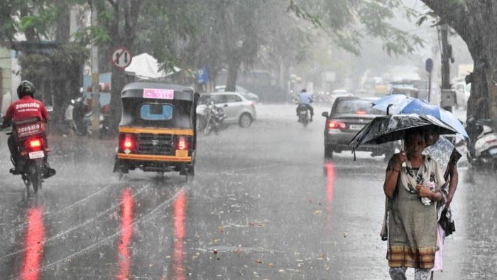
    Bhubaneswar: The monsoon season continues to have its effect on Odisha, with continuous rainfall affecting the state. Adding to the weather, a cyclonic storm is likely to cause the formation of a low-pressure field. This combined effect is expected to intensify the rainfall in the region, particularly in Western Odisha and the coastal districts.

    Several districts in the state are likely to experience heavy rainfall today and tomorrow. Some areas may experience heavy to very heavy rainfall. The weather department has issued an orange warning for various districts from the 31st July and 1st August indicating a high level of caution required during this period.

    As we approach the 31st, the intensity of the rainfall is expected to increase further, with heavy to very heavy rain predicted in most parts of the state.

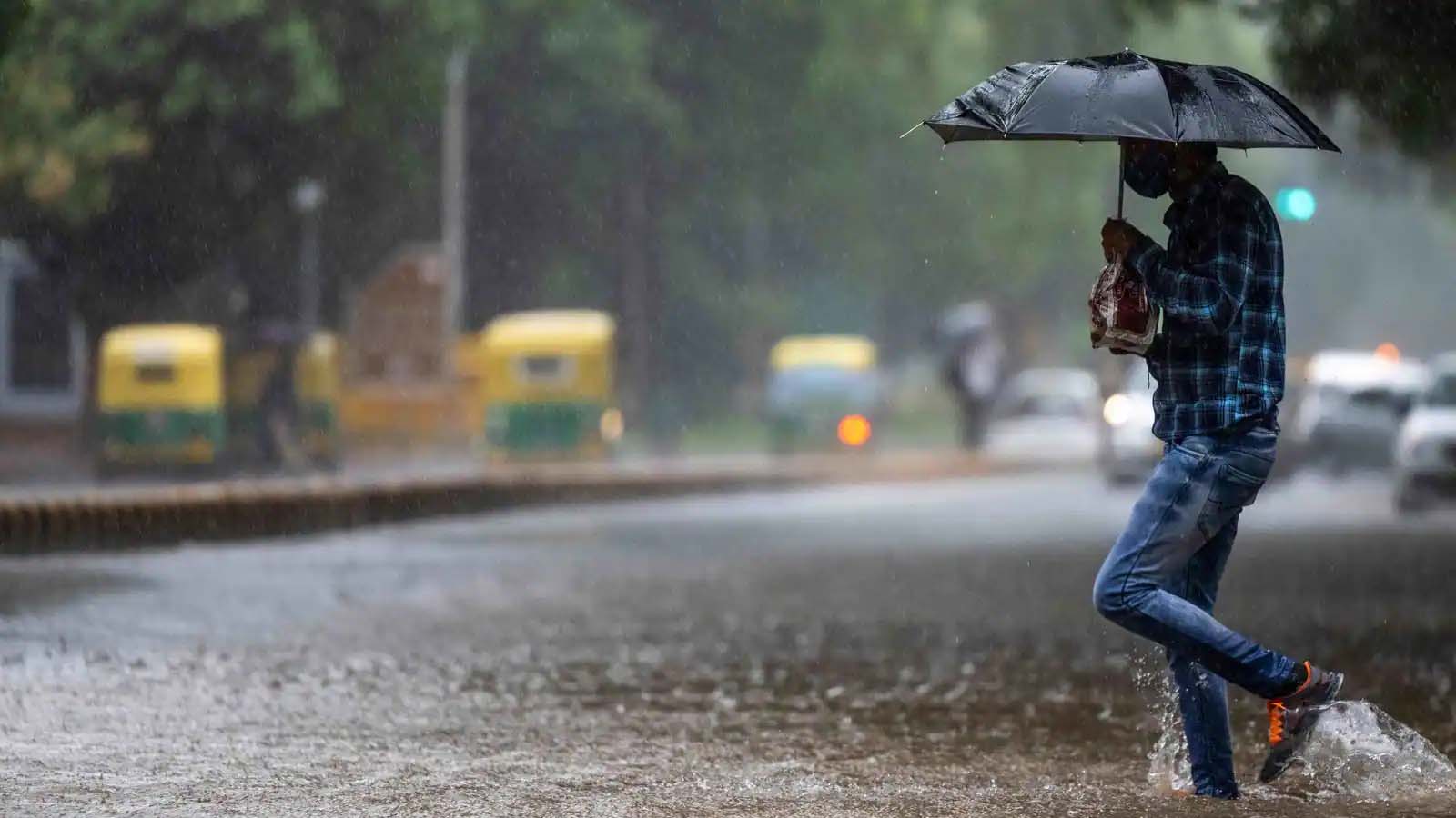
    An orange warning has been issued to several districts in view of very heavy rainfall on July 31 and August 1.

    Additionally, a yellow warning has been issued to 14 districts of the state for heavy rainfall today.

    Baripada recorded the highest rainfall of 28 mm yesterday and Keonjhar recorded a rainfall of 20 mm.

  • IMD forecasts heavy rainfall in Hyderabad, issues yellow alert

    IMD forecasts heavy rainfall in Hyderabad, issues yellow alert

    The India Meteorological Department (IMD) Hyderabad has forecasted heavy rainfall in the city on July 4 and 5. The weather department has also issued a yellow alert.

    According to the department, all six zones of Hyderabad, namely Charminar, Khairatabad, Kukatpally, LB Nagar, Secunderabad, and Serilingampally, will experience a generally cloudy sky. Additionally, the department has forecast moderate to heavy rainfall during the evening or night in the city. This weather pattern is expected on July 4 and 5, 2023.

    In the past 24 hours, the highest rainfall of 163.3 mm was recorded in Vikharabad. In Hyderabad, Jubilee Hills witnessed the maximum rainfall of 28.5 mm, according to the Telangana State Development Planning Society (TSDPS).

  • IMD Hyderabad forecasts rainfall in Telangana today

    IMD Hyderabad forecasts rainfall in Telangana today

    After yesterday’s heat wave warning for Telangana, India Meteorological Department (IMD) Hyderabad has forecasted rainfall for the state today. Today’s weather conditions are expected to bring thunderstorms, lightning, and squalls.

    However, along with the rainfall forecast, the weather department has also issued a heat wave warning for Telangana.

    Hyderabad is also likely to experience light to moderate rainfall or thundershowers during the evening or night. The temperature in Hyderabad is expected to range between 36-39 degrees Celsius, while the state as a whole may reach up to 44 degrees Celsius.

  • Bengaluru to get moderate rainfall over next 5 evenings

    Bengaluru to get moderate rainfall over next 5 evenings

    Bengaluru will likely receive light to moderate rainfall for the next five evenings, according to the India Meteorological Department (IMD). 

    While the southwest monsoon has arrived in the city, the upcoming rainfall will be brought about by convective activity. This occurs when the maximum temperature stays higher than normal for several days. 

    Convective rainfall occurs when the sun’s energy heats the earth’s surface, causing water to evaporate. 

    On Tuesday, the IMD’s Bengaluru city weather recorded a maximum temperature of 31.5°C, two degrees above normal. The HAL airport recorded a maximum temperature of 30.8°C, one degree above normal. 

    A Prasad, who heads the IMD’s meteorological centre in Bengaluru, said Cyclone Biparjoy had delayed the southwest monsoon’s progress. “The monsoon is actually weak. It’s not as strong as it should be,” he told DH. The cyclone is dragging all the moisture content, he added. 

  • Quake-hit Japan braces for more aftershocks, rain

    Quake-hit Japan braces for more aftershocks, rain

    Tokyo: Japan’s central prefecture of Ishikawa on Saturday remained on high alert for aftershocks and rain after a 6.5-magnitude earthquake struck the area, leaving one dead and 22 others injured.

    The Japan Meteorological Agency (JMA) has warned strong aftershocks could occur in the span of around a week following the initial temblor on Friday afternoon, which registered upper 6 on the Japanese seismic intensity scale of 7 in the city of Suzu on the tip of the Noto Peninsula.

    A 65-year-old man died in Suzu in Friday’s quake after falling from a ladder and the city said 22 others had been injured, Xinhua news agency reported.

    More than 50 aftershocks have already been recorded in the area by 8 a.m. local time, including a 5.8-magnitude quake on Friday evening, the JMA said, warning that heavy rain could trigger landslides in areas where the ground has been loosened by the quakes.

    The weather agency said the prefecture could see rainfall of up to 30 millimetre per hour from Saturday evening to early Sunday, with up to 120 mm forecast for the Noto area over the 24 hours through 6 a.m. of Sunday.

    Local authorities have started to assess damage caused by the quakes after receiving reports of collapsed buildings.

  • Hyderabad to receive rainfall till Thursday, forecasts IMD

    Hyderabad to receive rainfall till Thursday, forecasts IMD

    Hyderabad: The Indian Meteorological Department (IMD) has issued a yellow alert for Hyderabad, forecasting rainfall till Thursday, April 27.

    According to the IMD Hyderabad, all six zones in Hyderabad – Charminar, Khairatabad, Kukatpally, LB Nagar, Secunderabad, and Serilingampally – are expected to have a generally cloudy sky, with light to moderate rainfall or thundershowers expected towards the evening or night.

    Maximum temperature in Hyderabad
    While Hyderabad is expected to receive rainfall, the maximum temperature in the city is likely to be in the range of 36 to 40 degrees Celsius.

    This is in line with the forecast by the Telangana State Development Planning Society (TSDPS), which has also predicted light rainfall or thundershowers at isolated places towards the evening/night for the next three days.

  • Hyderabad wakes up to cloudy sky, lighting with heavy rainfall likely

    Hyderabad wakes up to cloudy sky, lighting with heavy rainfall likely

    Hyderabad: The residents of Hyderabad woke up to a cloudy sky and lighting on Friday, with heavy rainfall predicted for the day. Some parts of the city experienced rainfall in the early morning, with dark clouds hovering over most areas.

    The India Meteorological Department (IMD) Hyderabad has issued a yellow alert for the state for Friday and Saturday, warning of thunderstorms, lightning, and squalls.

    Hyderabad likely to see rainfall or thunderstorms
    According to the weather department, all six zones in Hyderabad – Charminar, Khairatabad, Kukatpally, LB Nagar, Secunderabad, and Serilingampally – are expected to have partly cloudy sky till April 17. Light rain or thundershowers towards the evening or night are also expected.

    Despite the rainfall, the maximum temperature in Hyderabad is forecasted to remain between 36 and 40 degrees Celsius until April 16. It is likely to increase to 41 degrees on April 17 and up to 45 degrees in the following days.

    Residents are advised to take necessary precautions and plan their travel accordingly in view of the rainfall forecast made by IMD Hyderabad.

  • Unexpected rain lashes parts of Mumbai, residents asked to stay on alert

    Unexpected rain lashes parts of Mumbai, residents asked to stay on alert

    Maharashtra: Mumbaikars on Tuesday woke up to light rains, which effectively bought down the heat. However, many low-lying areas are waterlogged due to the sudden downpour affecting the normal movement of people in the financial capital. Meanwhile, the India Meteorological Department (IMD) has issued a wet weather warning for Maharashtra over the next few hours, saying that multiple cities and districts were likely to experience a thunderstorm accompanied with lightning and rainfall.

    Thunderstorm accompanied with lightning and light to moderate spells of rain with gusty winds reaching 30-40 kmph very likely to occur at isolated places in the districts of Mumbai, Thane, Raigad during next 3-4 hours,” IMD Mumbai. From early morning on Tuesday, sudden rain lashes Thane, Goregaon, and Borivali areas. According to the forecast, the rain is likely to move towards Dadar, Parel, and South Mumbai in the next few hours. The local trains are functioning normally as of now. People going out for work would face some difficulties due to the general conditions of lightning and rain.”Westerly winds lead to moisture incursion from the Arabian Sea … Mumbai currently experiencing light to moderate rains …mostly in the suburbs”, tweeted Regional Meteorological Center, Mumbai. Yesterday, Mumbai saw a ‘good’ AQI as the System of Air Quality and Weather Forecasting and Research (SAFAR) dashboard in the afternoon showed the city’s overall AQI to be 89, which is regarded as ‘good+satisfactory’.